
Route 51 is the old road number for a highway that runs north-south for 1,286 miles. Most of it has now been swallowed by various interstate numbers. In Wisconsin it’s the I-39 and it runs off the map between Hurley, Wisconsin and Ironwood, Michigan, in UPer country. Get off the I system at the forgotten small towns along the route and you might still find some sign of what it was like to travel the main road up to the cabin in the north woods.
The southern end of old Highway 51 ends in Laplace, Louisiana, a little outside of New Orleans. I had a client that lived in southern Louisiana. We always chatted away like neighbors over a thousand mile long fence that ran down our road.
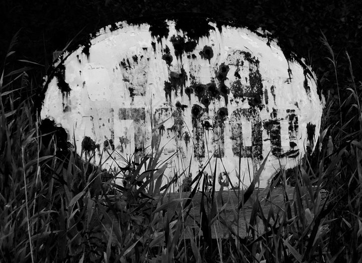
I’ve been driving past this old sign on and off for 13 years and finally decided to take a photo before it disappeared completely. I’ve enhanced it so the puzzle is almost legible. Have fun guessing, let me know what you think.


Heading north on County Highway CX, one remnant of old Highway 51 in Marquette County, Wisconsin, the old highway has already split three times since leaving Portage. I-39 pretty much gutted the villages closest to the interstate and left their shells to stand as ghost towns. Gone are the old community cafe, gas stations, and local grocers. Vacant lots litter main streets, side by side with boarded over, empty store fronts, some with faded plaques of more recent business failures. Driving north on old Highway 51 and looking for life is like grasping at the wind. The old road is part of a vanishing America.
http://www.wisconsinhighways.org/listings/WiscHwys50-59.html#US-051
Blog editorial content and photography copyright of Charly Makray-Rice
Please ask permission before re-posting. Thank you.

It’s interesting digging into the old stuff, what has been left behind by those who travelled before – echoes of my self …
Thank you for popping north and visiting. Look forward to seeing you again, Mark.